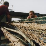
The information reveals that R/V G.O. Sars heading for the “Eggakanten”, the continental shelf break northwest off the Norwegian mainland, approximately half-way to the Bear Island. Its main aim is to map the seabed as part of the Norwegian mapping programme MAREANO.
It is informed that the cruise is split into two legs; the first, which we report from here, was undertaken between 18 and 30 September and the second leg which runs from 30 September until 11 October. Onboard were 14 scientists and technicians within the fields of marine taxonomy, geology and chemistry.
The first location of the mission is at 1015 m depth in the southern part of the Bjørnøya slide area. Here, they used the new, light fiber-optic cable for the first time. With this cable we will be able to use the tethered video platform deeper than earlier. This will be needed during the second leg where one of the main goals is to map the deep seafloor down to around 2700 m.
The crew opined that during the eight days of fair weather conditions they surveyed 41 locations with the tethered video platform and sampled the seabed with different gear at six locations. There is a big difference in bottom type, temperature and faunistic composition related to depth. On the shelf (< ca 400 m) there are many signs of the last glaciation and a great variation in the strength of the bottom currents and sediment types. They find iceberg ploughmarks and almost any type of seabed, with a high diversity of species associated with the Northeast Atlantic water mass. On the shelf in this region we commonly find sponge habitats with a characteristic composition of Geodia spp. The shelf break (400-500 m depth) is commonly exposed to strong currents where the seabed may consist of gravel or large waves of sand in slow motion.

